The GIS & Remote Sensing Undergraduate Certificate provides a hands-on introduction to the world of Geographic Information Systems (GIS), satellite remote sensing, and spatial data analysis. This program equips students with the skills to visualize, interpret, and analyze spatial data to support critical decision-making in fields like public health, environmental conservation, disaster response, and more.
Why Choose This Program?
- Access to Industry Leaders: Learn from faculty with real-world experience in applied research and geospatial solutions.
- Strategic Location: Based in Huntsville, AL, home to NASA’s Marshall Space Flight Center and major defense and aerospace organizations, providing unique internship and career opportunities.
- Accredited: This certificate is accredited by the Southern Association of Colleges and Schools Commission on Colleges, ensuring a high-quality education.
Enrollment is simple:
- Current UAH Students: You can enroll via your myUAH account or discuss with your academic advisor.
- New Students: Apply through the University Registrar’s Office.
If you have questions or need more information, please reach out to the Department Chair at aes.chair@uah.edu.
What is GIS?
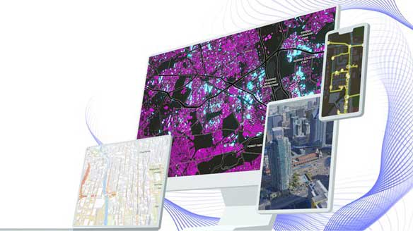
Geographic Information Systems (GIS) are tools that help us collect, manage, and analyze data tied to specific locations on Earth’s surface. GIS technology is used for tasks such as mapping, environmental analysis, and urban planning. It integrates layers of spatial data (like roads, population, and land use) that can be analyzed to support decision-making.
In this program, students learn to use GIS software like ArcGIS and QGIS, and gain valuable programming skills (e.g., Python) for advanced spatial analysis.
What is Remote Sensing?
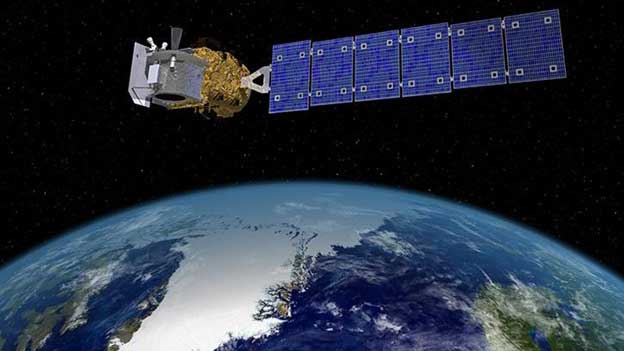
Remote sensing involves collecting data about the Earth’s surface from a distance, typically using satellites, drones, or aircraft. This technology helps monitor environmental changes, map natural disasters, and assess land use from a global to local scale. With remote sensing, you’ll learn how to process satellite imagery, analyze spectral data, and use various sensors for environmental and geographic analysis.
By the end of the program, students will be able to integrate GIS and remote sensing for more powerful geospatial insights.
Program Courses
The GIS & Remote Sensing Certificate includes five core courses designed to build your technical and analytical skills:
- AES 313 - Geographic Information Systems
Introduction to GIS, spatial data management, and basic analysis using ESRI and open-source software. - AES 370 - Introduction to Remote Sensing
Learn how satellite and aerial imagery are used for environmental and geographic analysis - AES 408 - GIS Programming
Focus on automating spatial analysis and customizing tools using Python and other programming languages. - AES 414 - Cartography & Applications
Principles of map design and the art of communicating spatial data through compelling, accurate maps. - AES 415 - Advanced Geographic Information Systems
Advanced topics in spatial analysis, modeling, and geospatial statistics.
These courses can often be taken online, in-person, or through a combination of both, offering flexibility to students with different learning preferences.
Career Opportunities
A certificate in GIS and Remote Sensing opens doors to a variety of career paths in both the public and private sectors, including:
- Aerospace & Defense
- o Positions: Geospatial Analyst, Remote Sensing Scientist, Imagery Intelligence Specialist
- o Employers: NASA, U.S. Army Corps of Engineers, Redstone Arsenal, NGA
- Environmental & Natural Resource Management
- Positions: Environmental Analyst, Conservation GIS Specialist, Ecological Modeler
- Employers: EPA, U.S. Geological Survey, The Nature Conservancy, National Park Service
- Disaster Response & Emergency Management
- Positions: GIS Analyst, Hazard Mapping Specialist, Emergency Management Coordinator
- Employers: FEMA, Red Cross, Department of Homeland Security
- Commercial Sector
- Positions: Location Intelligence Analyst, Remote Sensing Consultant
- Employers: ESRI, Amazon Web Services (AWS), Planet Labs, private sector companies
For more information on careers in GIS and Remote Sensing, visit Indeed.