NASA awards $849K to UAH-led project to improve flash drought early warning across Southeast
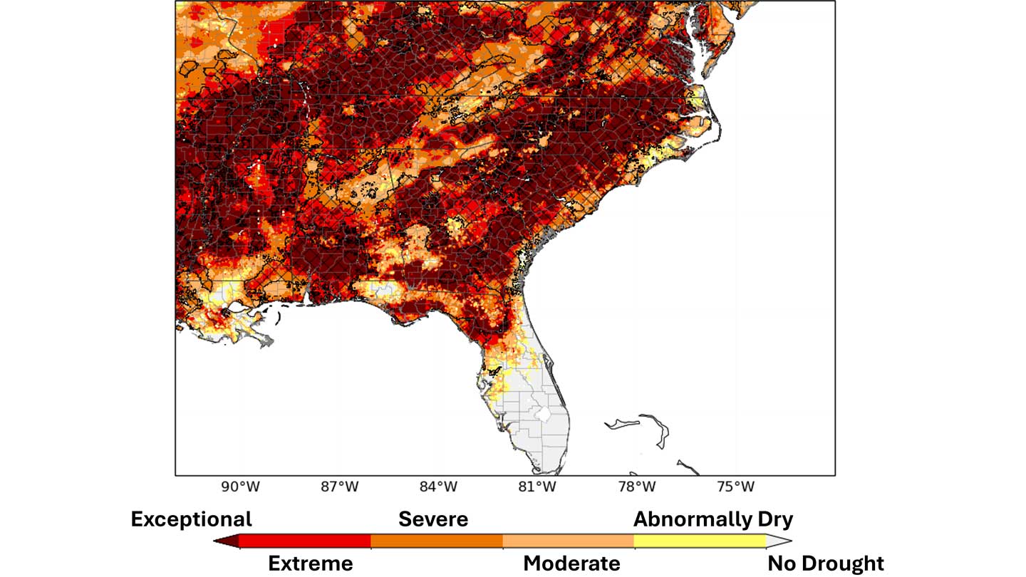
SPoRT-LIS soil moisture percentile map from April 14, 2026, with hatched areas showing where Soil Moisture Volatility Index flash drought criteria were met across the Southeastern United States.
Flash droughts can develop in a matter of weeks, often before traditional drought indicators fully capture the growing risk. Now, a University of Alabama in Huntsville (UAH)-led project has been awarded $849,000 from NASA to help communities across the Southeastern United States identify, monitor and respond to these rapidly emerging drought conditions sooner. UAH is a part of The University of Alabama System.
Led by Jonathan Case, principal research scientist with UAH’s Earth System Science Center (ESSC), the project will bring together state climatologists, federal partners and drought experts to develop new tools that track rapidly drying soils and predict how flash drought conditions may affect streamflow across the region.
Spanning a three-year period from summer 2026 to summer 2029, the effort will focus on co-developing tools to support drought mitigation across the Southeast Drought Early Warning System (SE DEWS) – a regional network of partners connected through NOAA’s National Integrated Drought Information System (NIDIS) working to help stakeholders and decision makers prepare for, mitigate, and respond to the effects of drought. Key partners on the project include the Alabama Office of the State Climatologist (AOSC) located at UAH, the Tennessee Climate Office (TCO) located at East Tennessee State University, and the broader NIDIS SE DEWS region.
“Our research team is greatly appreciative of NASA selecting our proposal. We look forward to co-developing and delivering impactful operational tools that will help local, state and national officials to better anticipate and prepare for rapid-onset drought events in the Southeast U.S.” Case says.
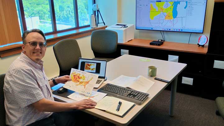
Jonathan Case, principal research scientist with UAH’s Earth System Science Center, reviews U.S. Drought Monitor data which will benefit from the NASA-supported flash drought early warning project.
The team seeks to develop decision-support tools that can improve early awareness of rapid onset and intensifying drought across the region by examining areas of fast-drying soil moisture content. The project will use land surface modeling datasets, which combine weather, soil, vegetation, and other environmental information to estimate soil moisture conditions and energy exchanges. These soil-moisture monitoring tools will be designed to help researchers and drought decision-makers recognize areas where drought conditions may be rapidly developing before most current drought indicators detect these changes.
The project will also use artificial intelligence to help predict how rapid drought onset or intensification can lead to low streamflow in unmanaged streams across the Southeast. Low streamflow during drought can affect navigation, energy production, recreation, water quality and water resources management, making earlier awareness important for communities and agencies that depend on water availability and timely drought information.
The effort also builds on Case’s long-standing work with NASA SPoRT and the Land Information System (LIS). Case played a leading role in developing SPoRT-LIS, a real-time, high-resolution land surface modeling framework that has helped make soil moisture information more accessible for drought monitoring. The new project builds on that foundation by applying NASA-supported modeling capabilities to flash drought early warning across the Southeast. Rather than replacing existing drought tools, the project is designed to provide unique, customized information for experts who assess conditions and communicate drought risk to state, regional, and national partners.
The AOSC and TCO will play a key role in evaluating how the tools will support real-world drought monitoring and communication. Case also serves as an author for the U.S. Drought Monitor, adding another connection between UAH research and national drought assessment efforts.
“Rapid-onset drought is a growing challenge in Alabama and across the Southeast, particularly for our agricultural communities. We are excited to work alongside the Tennessee Climate Office to co-develop and evaluate the tools developed through this project and build on resources like the NASA SPoRT-LIS and our Lawn and Garden Index to better monitor soil moisture conditions and support drought assessment efforts across the state,” Dr. Lee Ellenburg, Alabama State Climatologist, says.
In Tennessee, the tools will support drought monitoring, weekly drought communication and input to the U.S. Drought Monitor process. “We work with a lot of farmers, producers, agriculture extension agents, utility companies, and others throughout the year. During flash drought events, these groups share their frustrations about a perceived delay between what the Drought Monitor shows versus the impacts they’re seeing. We hope this research will reduce that delay and result in a more accurate representation of weekly conditions in the Southeast, especially during the warmer months of the year,” Dr. Andrew Joyner, Tennessee State Climatologist, says.
The project will also provide more localized information about changing drought conditions, helping to support agriculture planning, emergency management, water utilities, and watershed management.
Through collaboration with NOAA drought and water resource partners, the project connects regional drought monitoring needs with national water prediction efforts. What the team learns in the Southeast U.S. could help inform future work on low-flow prediction, including applications connected to the National Water Model, which supports streamflow and water-resource forecasting across the country. “Investigating the relationship between soil moisture changes and low-flow events in more natural conditions is a needed step to successfully enhance the low-flow calibration in more managed systems across the country,” says Dr. Elliot Wickham, Southeast Drought Regional Information Coordinator for NIDIS and Drought Community Lead with the National Water Center.
Through this UAH-led effort, researchers are helping advance NASA Earth Science to Action priorities through collaboration with state and federal partners and regional hydrologic research efforts. The project combines research expertise with on-the-ground decision-making needs, an important connection because drought decisions affect communities, agriculture, water resources, and emergency planning. By working directly with the agencies that monitor and communicate drought risk, the UAH-led team is helping ensure the science is co-developed with real-world needs in mind.
Contact
Julie Jansen
256.824.6926
julie.jansen@uah.edu